Features
Map position and service status software AVLS (monitoring) is designed to work with all systems:
AVLS display real time position of vehicles on map with addition details such as speed and direction. The software is centerpiece of the system. AVLS is compatible with Google Map, which interesting design. The software monitors all vehicles in the system. Any unscheduled movement is easily spotted, recorded and reported (high speed, deriving out of lane, more than usual stop etc.). The software also sends alarm and notification automatically to the derivers interface.

view vehicle location via the Internet mobile
With this possibility you can view. position of your vehicle anywhere in Iran by the mobile phone.

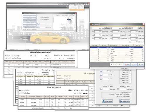
Auto-ticket, money card management and financial reports software (AFCS)
AFCS is centerpiece of all public transportation system and sub-system

Some features:
Map position and service status software AVLS (monitoring) is designed to work with all systems:
AVLS display real time position of vehicles on map with addition details such as speed and direction. The software is centerpiece of the system. AVLS is compatible with Google Map, which interesting design. The software monitors all vehicles in the system. Any unscheduled movement is easily spotted, recorded and reported (high speed, deriving out of lane, more than usual stop etc.). The software also sends alarm and notification automatically to the derivers interface.

view vehicle location via the Internet mobile
With this possibility you can view. position of your vehicle anywhere in Iran by the mobile phone.

- SQL Server 2008 data center
- Comprehensive system with
- Tehran/ Iran map (standard map) and other cities map (optional)
- Tehran Streets and paths data bank Tehran city public place data bank (hospital, hotel, public organization, restaurants, gas station, universities and etc.)
- Online position, speed, direction display
- Different types of reports
- Easier data analysis
- Defining rules and codes such as maximum speed, places, standard messages
- Travelled distance in specific period of time
- Bidirectional voice communication through the system (cars)
- Defining access level for operators
- Reporting based on access level of user
Auto-ticket, money card management and financial reports software (AFCS)
AFCS is centerpiece of all public transportation system and sub-system

Some features:
- Diagram and statistical reports of inter/intra-city transportation system in a specific period of time
- Defining money card groups
- Defining special rates for specific groups of social level and money card according to public policies
- Derivers and staffs control
- Financial reports and transactions and provided services by each derive
- Card money charged by each station
- Recording amount, date, and time of card money transaction in specific time limit
- Defining and modifying regions, lanes, vehicles, staffs, stations and kiosks
- Derivers account lists
- Defining different access level
- Optional reports
Key words:
GPS, GPRS, positioning, tracking, map tracker, ITS, motion marker, intelligent traffic controller, satellite controller, taximeter, taxi, transportation system control, transportation system, edge touching, transportation, Offline GPS, Online GPS, satellite communication, control center, positioned, hidden PGS, car GPS, automobile GPS, online communication, tracker, GSM, vehicle locater


